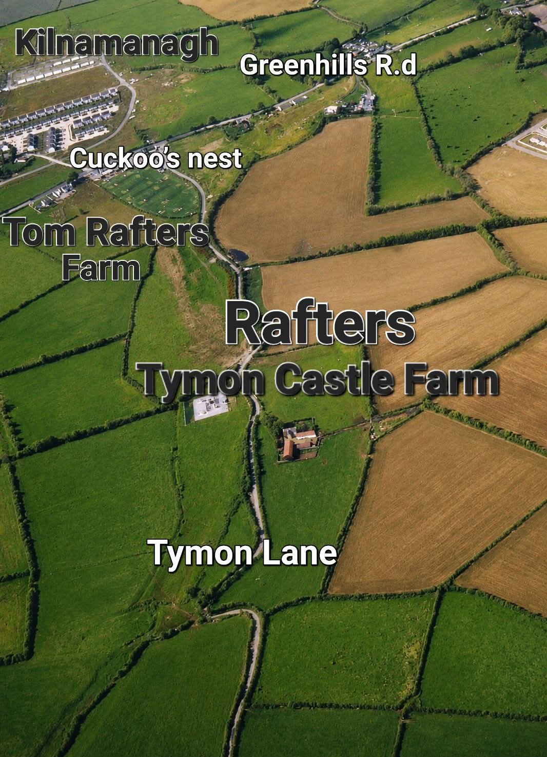
The Flanagan farm, Greenhills road - 20th century
The
Flanagan farm, Greenhills road, Kilnamanagh, Co.Dublin.
In the mid-late 20th century, when photos existed but before the house was lost.
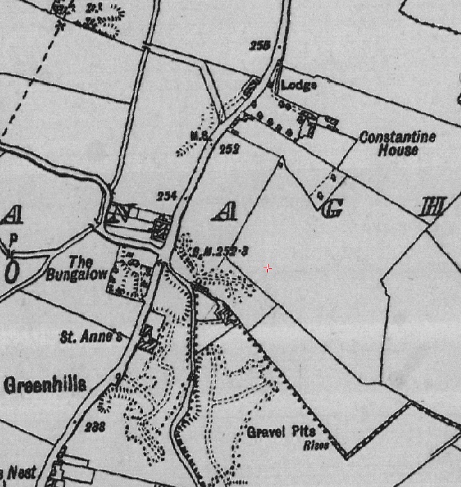
The area on 1935-1938 map.
From
South Dublin Historical Mapping.
The Flanagan farm is just below Constantine House, at the roadside.
Note there is no house down slope except
Constantine House.
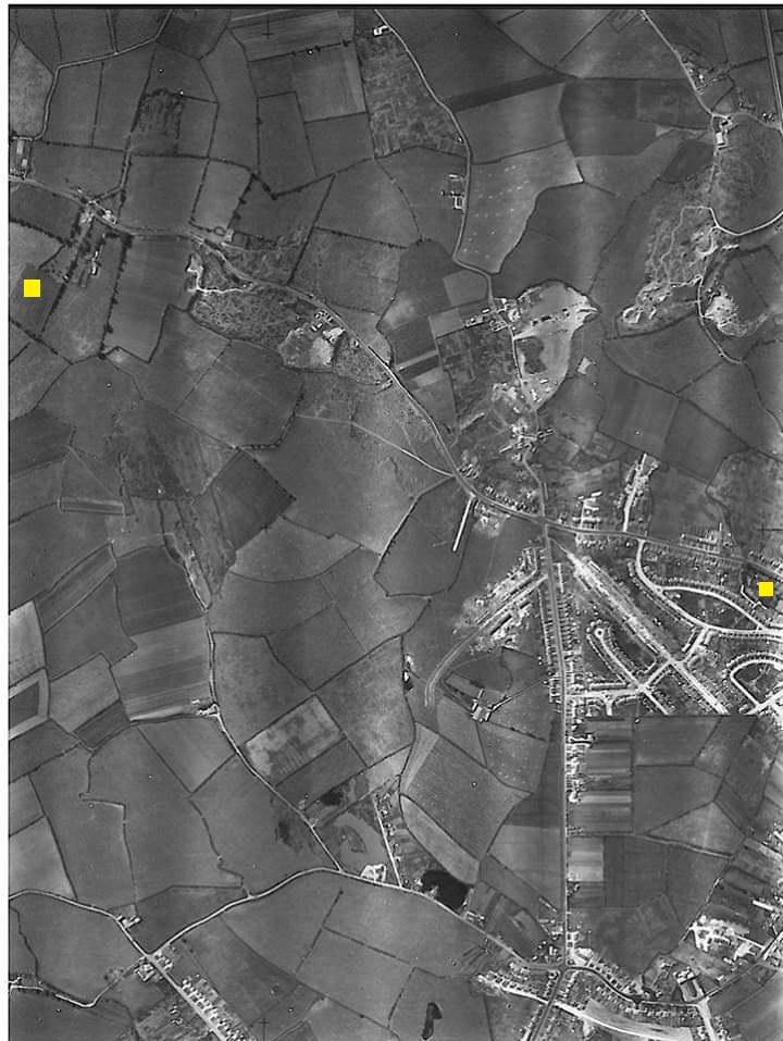
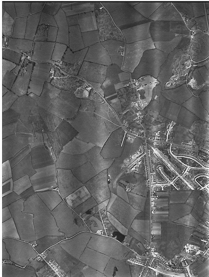
Aerial photo dated 1949.
LHS yellow square is the Greenhills farm. House at roadside. To RHS is Constantine House.
RHS yellow square is
Walkinstown House.
See
original.
Posted by Mick Rooney
here.
So far I have not been able to find the source.
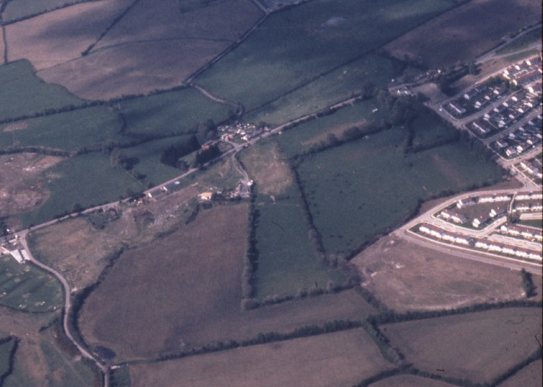
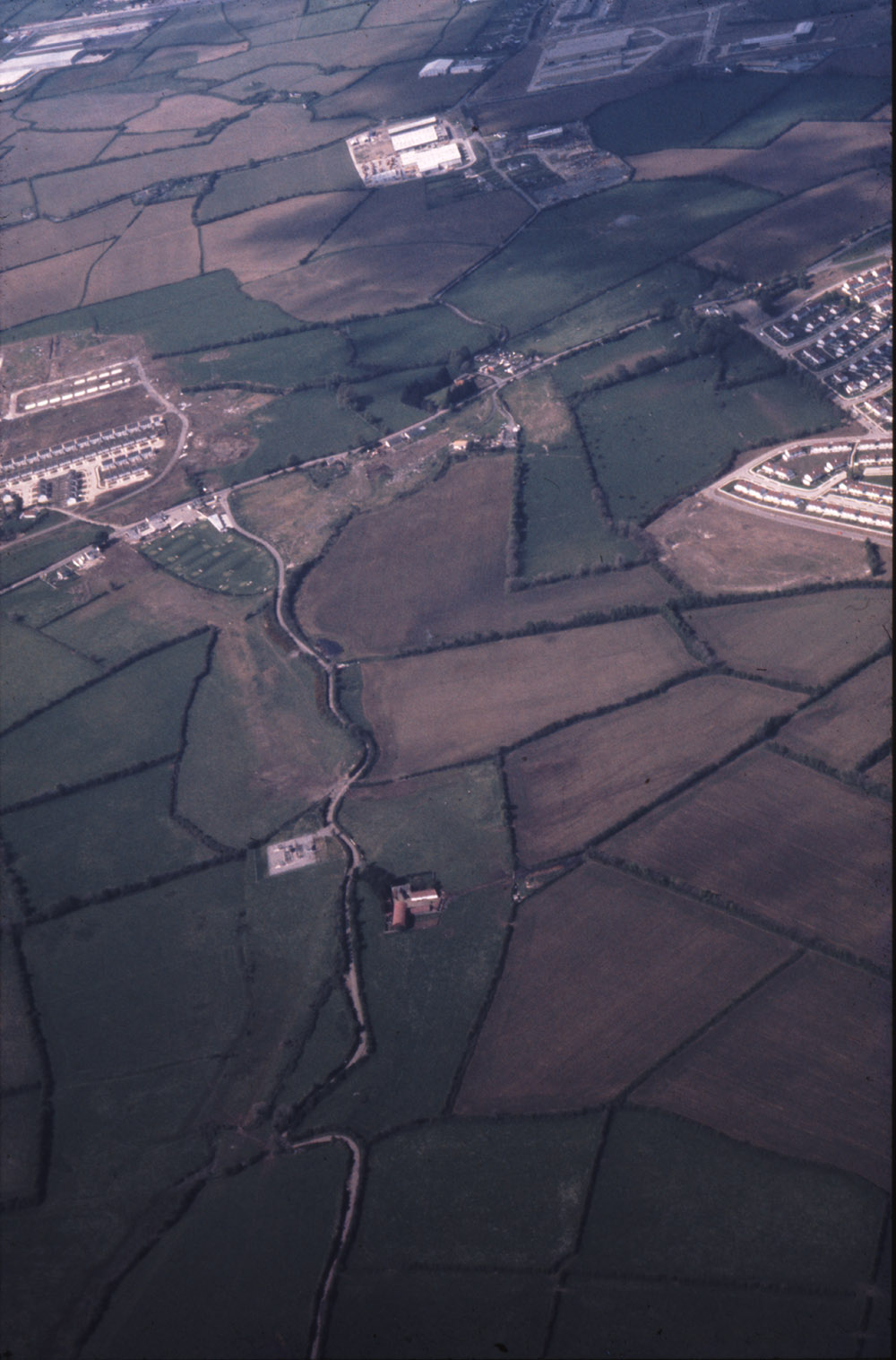
The Flanagan house and farm surviving in the late 20th century.
The Flanagan house is right beside the housing estate, at the roadside.
Shows the house and farm were still there when the first parts of the housing estate were built.
From
Leo Swan Archive.
Reference
LS_AS_35CT_00056_12m.
From
here.
Labelled as:
"Oblique aerial photograph .. of Tymon North".
See
full size.
See
other copy.
See
other copy
from
here.
-
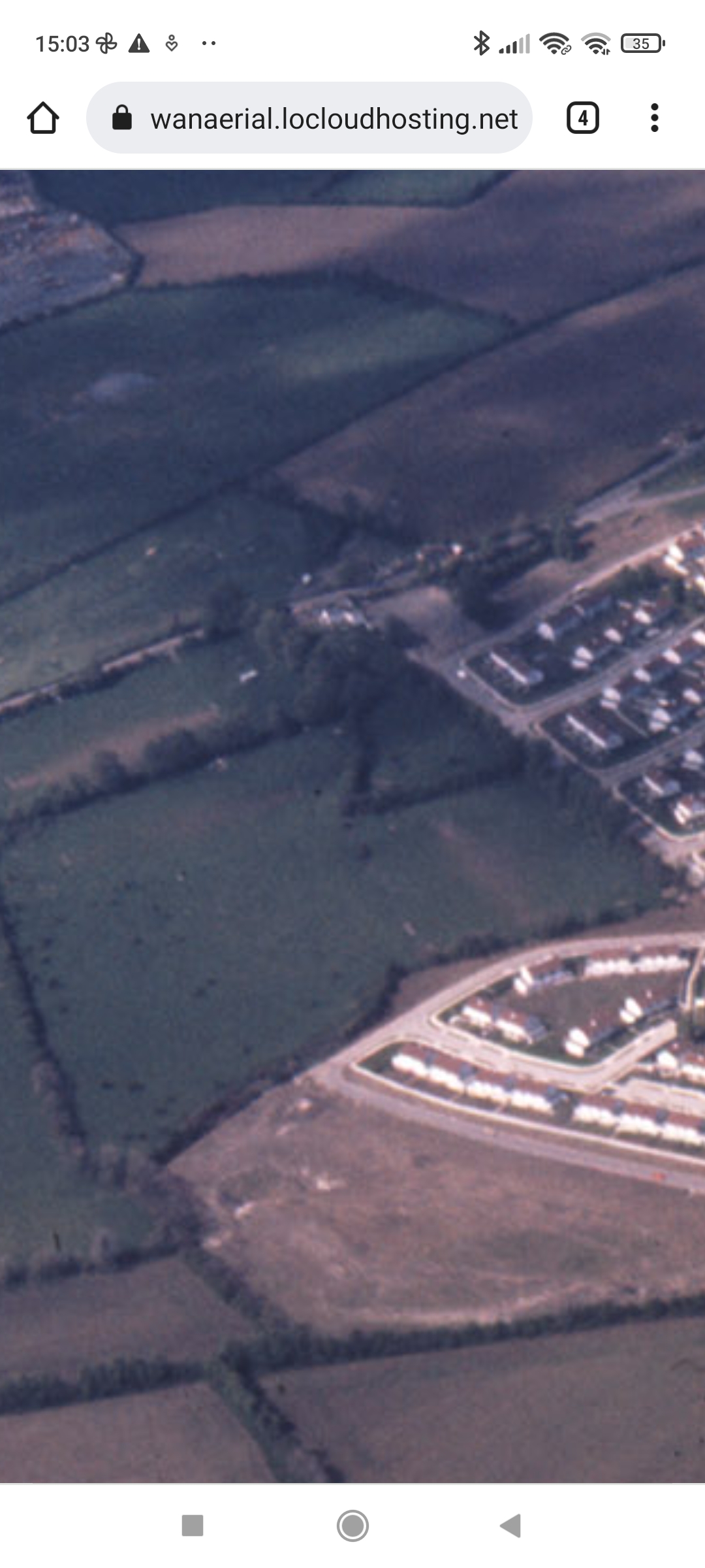
The Flanagan house is the old farmhouse at the roadside, on the bottom side of the road as we look here,
to the RHS.
-
Beyond it to the RHS is the new housing estate.
Constantine House is gone.
-
Below the Flanagan house you can see the shape of plot 15.
-
There is another old house on the top side of the road to the RHS. (This is still there today.)
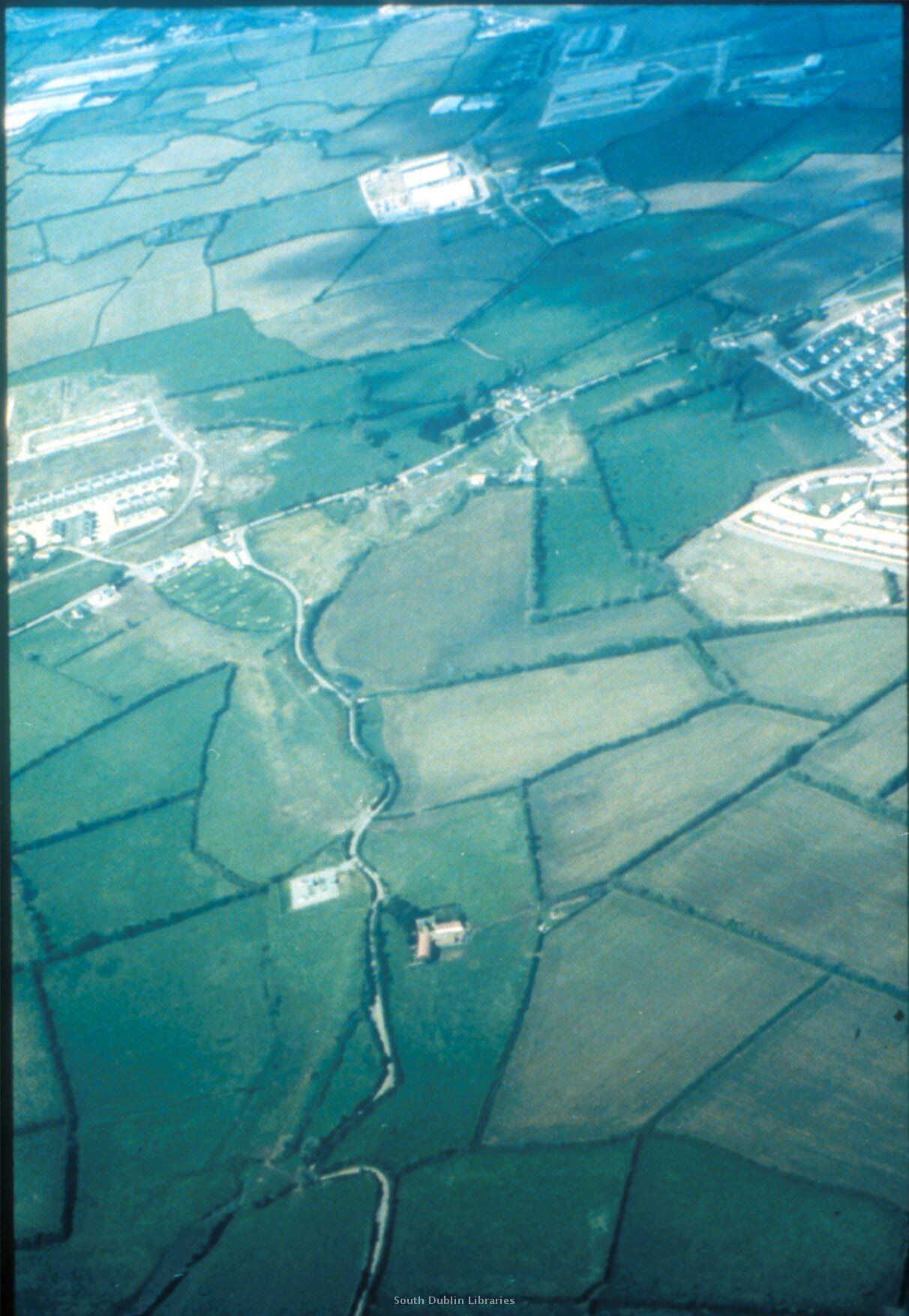
Identical photo to the above? Enhanced?
Flanagan farm in top RHS.
Flanagan house in very top RHS at the road.
See
full size.
Apparently posted
here.
